Rock Climbing
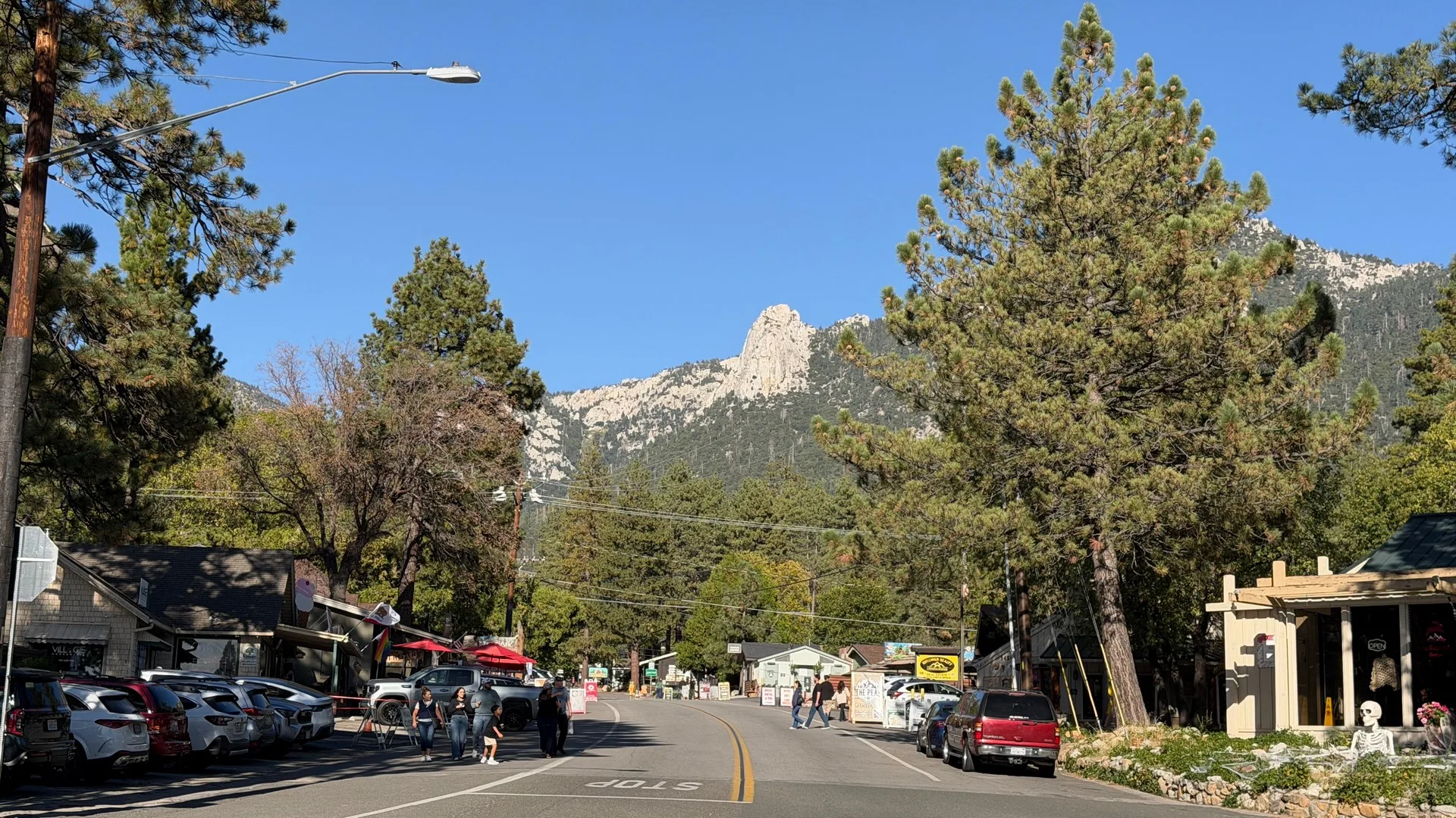
Two granite crags above town carry Idyllwild rock climbing: Tahquitz Rock, where the decimal grading system was worked out in the 1950s, and Suicide Rock, which looks back at it across the village.
- Parking
- Adventure Pass at Humber
- Water
- Carry your own
Access notes come from the Idyllwild Climbers Alliance and the San Jacinto Ranger District, who look after the rock.
Tahquitz Rock
Tahquitz Rock, also called Lily Rock, is where a good part of American rock climbing grew up. Jim Smith of the Sierra Club’s Rock Climbing Section first tried its west face in 1935, and in the summer of 1936 Jim Smith, Bob Brinton and Zach Jasaitis made the first climb, The Trough (5.4). Dick Jones led the Mechanics Route (5.8) in 1937, and Chuck Wilts added routes like Fingertrip (5.7) in 1946.
In the 1950s, Tahquitz climbers needed a better way to say how hard a route was. Royal Robbins, Don Wilson and Chuck Wilts broke the fifth class into a decimal scale, from 5.0 to 5.9, and Robbins pushed to put it in their first full guidebook, published in 1956. That became the Tahquitz Decimal System, and later the Yosemite Decimal System that climbers across North America use today. Robbins made the first free ascent of The Open Book in 1952, one of the hardest free climbs in the country at the time. In 1959 he and Dave Rearick put up The Vampire.
It’s traditional climbing on exfoliating granite. The Idyllwild Climbers Alliance recommends a full trad rack, long slings, quickdraws, a helmet and a 70-meter rope (60 will do). The ratings are old-school: established in the decimal system’s first years, they often feel stiff next to modern gym grades.
Getting there. Both approaches start at Humber Park, where parking needs an Adventure Pass. For the west and south faces, walk the Ernie Maxwell Trail about a quarter mile, then take the steep climbers’ trail straight up to Lunch Rock. For the north side, take the North Gully approach from the upper Humber Park lot.
Suicide Rock
Suicide Rock, the smaller crag facing Tahquitz, was mostly overlooked until the late 1960s. Between 1966 and 1969, Pat Callis and his friends put up 30 new routes there. In 1970, Ivan Couch, Larry Reynolds and Mike Dent climbed Valhalla (5.11a), and in 1973 Mike Graham and Tobin Sorenson did New Generation (5.11c). Through the 1970s, the Stonemasters, a crew that included John Long, Rick Accomazzo, John Bachar and Lynn Hill, made both rocks their training ground. More than 500 new routes have gone up on the two crags and around them since 1979.
The climbing is granite slab and face, much of it established ground-up, so bolts on the slabs can be 10 to 20 feet apart. Bring a trad rack, long slings, quickdraws, a 60 or 70-meter rope and a helmet. The Sunshine Face, the North Face and the Weeping Wall are the main areas.
Getting there. The approach starts across from Forest Drive at Fern Valley, where there’s a sign. It climbs stairs the Climbers Alliance built and maintains, crosses the creek, follows a short stretch of paved road and then becomes single track. You park on Forest Drive, where the Alliance says no Adventure Pass is needed. The lower part of the trail runs very close to private homes, and access here has been a problem in the past, so stay on the trail, keep your voice down and park considerately. [VERIFY: the district’s trail guide says to sign the register a short way up the Climbers Trail and that the register is your permit; the Climbers Alliance says no permit is needed. Confirm whether the register is still in place.]
Bouldering and the rest of the mountain
The granite doesn’t stop at the two big crags. The Climbers Alliance lists:
- Idyllwild Regional Park. Walking distance from town, with a good variety of problems. They sit right beside the campsites, so the main hazard is people.
- South Ridge. Bouldering along the ridge near the forest’s yellow-post campsites. The access road is steep and rutted and needs good clearance, though two-wheel drive usually does it. Snow and heavy rain close it.
- Black Mountain. About 7,600 feet up, so noticeably cooler in summer. Take Highway 243 about 12 miles north of Idyllwild, then roughly 4 miles on the forest road to Boulder Basin Campground. The road closes with winter snow and rain, and the Forest Service recommends four-wheel drive for it; check the Boulder Basin page for the road before you go.
- The Tramway. Many high-quality problems around 8,500 feet at the top of the Palm Springs Aerial Tramway (the tram charges a fare).
- The Hinterlands. A line of granite towers running east from Tahquitz, with steep gullies of snow and ice for alpine climbing in a good winter.
Access, permits and the wilderness
Tahquitz and Suicide sit almost entirely inside the federal San Jacinto Wilderness. Check with the San Jacinto Ranger District whether your approach needs a wilderness permit. If your day turns into a hike past the crags, the hiking rules apply: a free wilderness permit for any trail into the wilderness, and our permits and trail rules cover the rest.
Wilderness rules still hold at the base of the rock. Groups of 12 or fewer. No campfires. No motorized equipment. Pack out everything you bring, including tape and old slings. Dogs must be on a leash of 6 feet or less in the national forest. Before you place any new bolt or fixed anchor, check the current rules with the Climbers Alliance and the Forest Service.
The San Jacinto Mountains are the ancestral home of the Cahuilla people. Climb like a guest.
Before you tie in
The Climbers Alliance’s hazard list, in short:
- Loose rock, especially on the north side of Tahquitz, where freeze and thaw work at it every winter. Don’t climb directly under another party on routes known for rockfall.
- Early-season snow and water. Snowdrifts at the base, wet routes, and running water or ice in the cracks.
- Old slings. Don’t trust the tat around trees. A climber died when a single old nylon sling broke on rappel.
- Rattlesnakes, spring through fall.
- Descents are steep, with exposure.
Cell service is spotty or nonexistent. In an emergency, call 911; the Riverside County Sheriff runs helicopter rescues on this mountain. The Alliance keeps rescue litters near Lunch Rock at Tahquitz and at the base of the Weeping Wall on Suicide.
Guides, gear and guidebooks
The Idyllwild Climbers Alliance looks after access, trails and anchors on both rocks. For anything that changes, its site is the place to check.
Need a guide or gear? Vertical Adventures guides climbs here, and Nomad Ventures is the local outdoor store.
The standard guidebooks are Tahquitz and Suicide by Randy Vogel and Bob Gaines, and Best Climbs: Tahquitz and Suicide Rocks by Bob Gaines. For bouldering, the Climbers Alliance points to the Southern California Bouldering Guide by Craig Fry.
Keep going